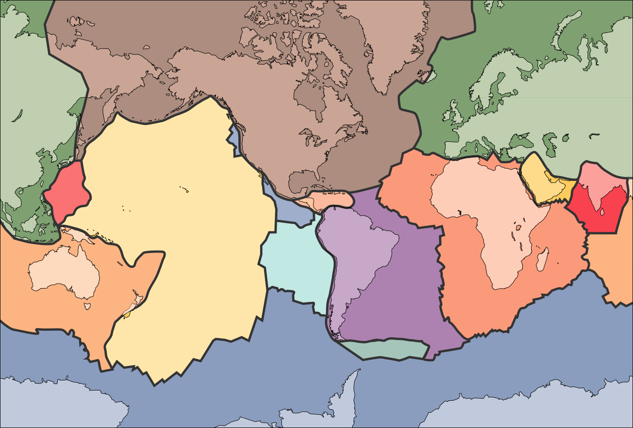
ไฟล์:Tectonic plates (empty).svg
ไปยังการนำทาง
ไปยังการค้นหา

ขนาดของตัวอย่าง PNG นี้ของไฟล์ SVG นี้: 681 × 461 พิกเซล ความละเอียดอื่น: 320 × 217 พิกเซล | 640 × 433 พิกเซล | 1,024 × 693 พิกเซล | 1,280 × 866 พิกเซล | 2,560 × 1,733 พิกเซล
ไฟล์ต้นฉบับ (ไฟล์ SVG ขนาดประมาณ 681 × 461 พิกเซล, ขนาดไฟล์: 356 กิโลไบต์)
ความย่อ
| คำอธิบาย | |
| วันที่ | 10 กันยายน พ.ศ. 2548 (upload date) |
| แหล่งที่มา | File:Tectonic plates (empty).png |
| ผู้สร้างสรรค์ | Ævar Arnfjörð Bjarmason |
| เวอร์ชันอื่น |
This file was derived from: Tectonic plates (empty).png:
[]
|
| SVG genesis |


.png)


.svg)
.png)
การอนุญาตใช้สิทธิ
This image is in the public domain in the United States because it only contains materials that originally came from the United States Geological Survey, an agency of the United States Department of the Interior. For more information, see the official USGS copyright policy.
|
ประวัติไฟล์
คลิกวันที่/เวลาเพื่อดูไฟล์ที่ปรากฏในขณะนั้น
| วันที่/เวลา | รูปย่อ | ขนาด | ผู้ใช้ | ความเห็น | |
|---|---|---|---|---|---|
| ปัจจุบัน | 23:32, 29 สิงหาคม 2567 | | 681 × 461 (356 กิโลไบต์) | wikimediacommons>RXFADEZ | restored Hispaniola to be a single island |
การใช้ไฟล์
1 หน้าต่อไปนี้ใช้ไฟล์นี้:
.svg)